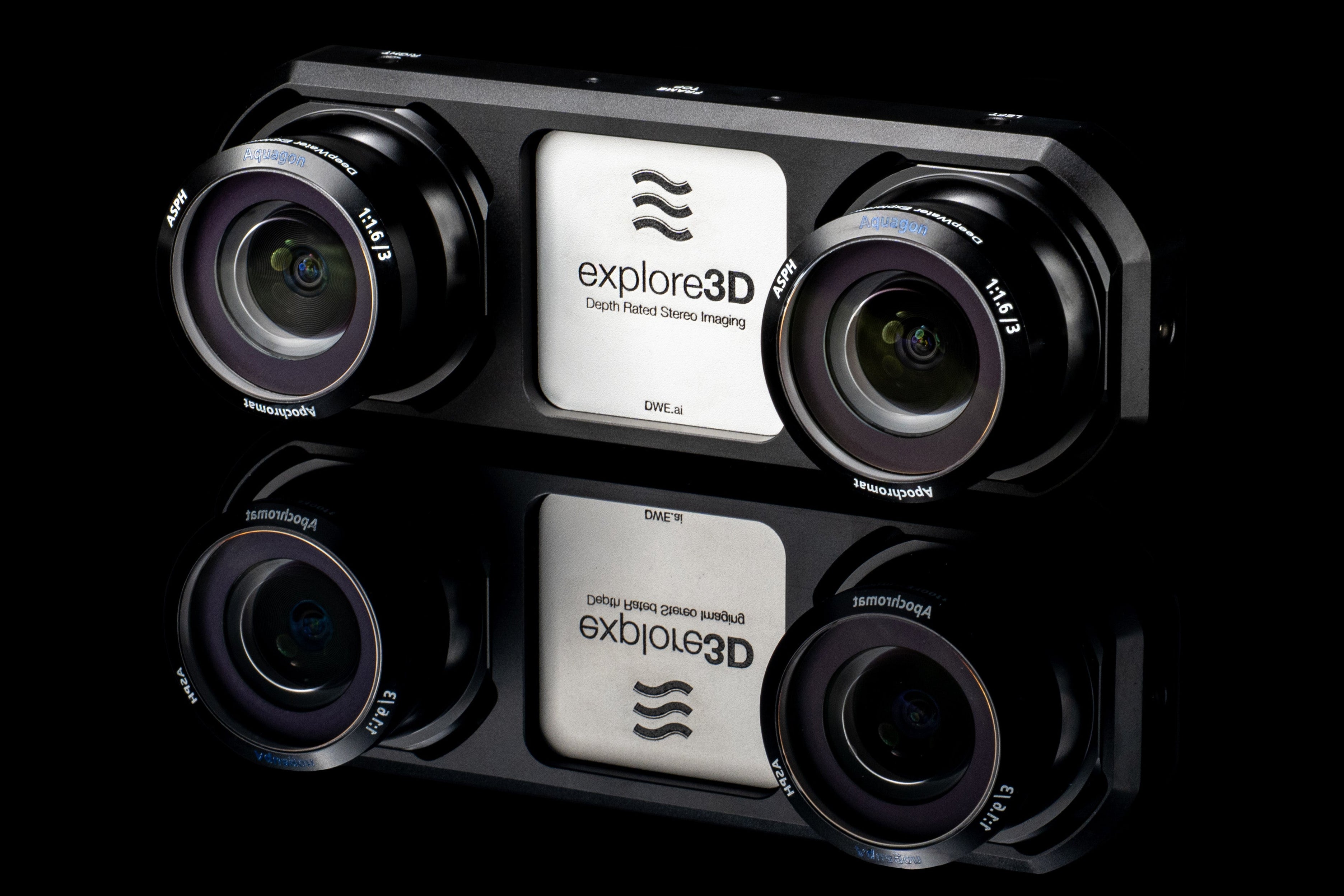
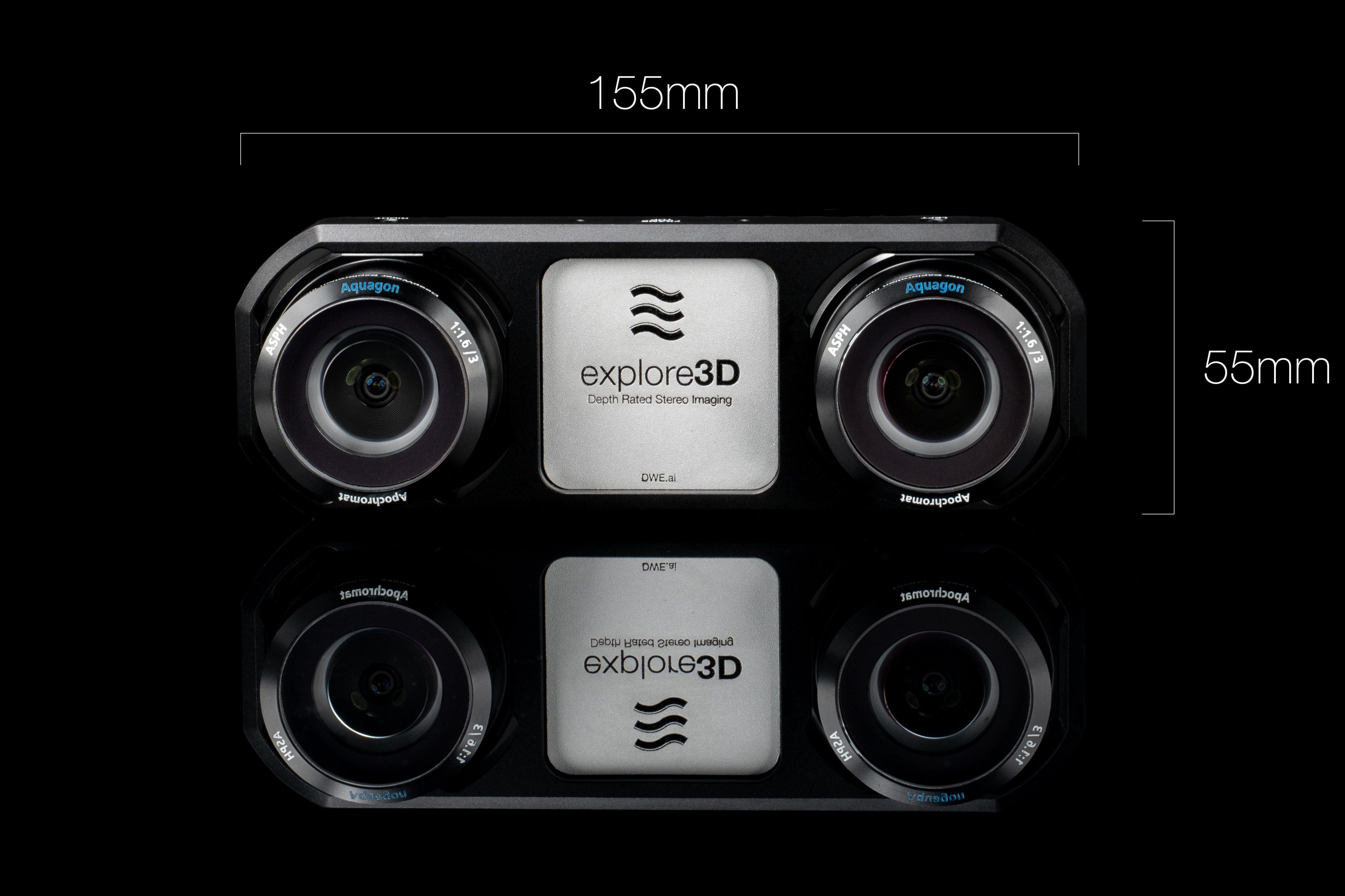
DWE-E3D-C-ECF-C
explore3D (1000m - 11000m)
DWE SDK Available Upon Request
Pairs well with


If you have any questions, you are always welcome to contact us. We'll get back to you as soon as possible, within 24 hours on weekdays.
-
Shipping Information
Use this text to answer questions in as much detail as possible for your customers.
-
Customer Support
Use this text to answer questions in as much detail as possible for your customers.
-
FAQ’s
Use this text to answer questions in as much detail as possible for your customers.
-
Contact Us
Use this text to answer questions in as much detail as possible for your customers.
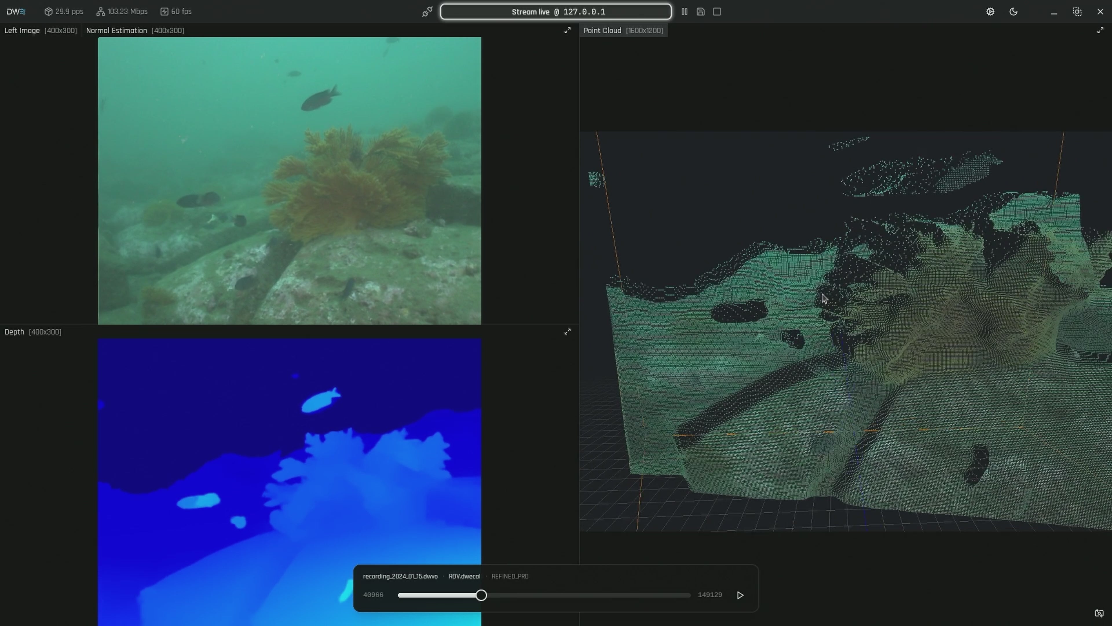
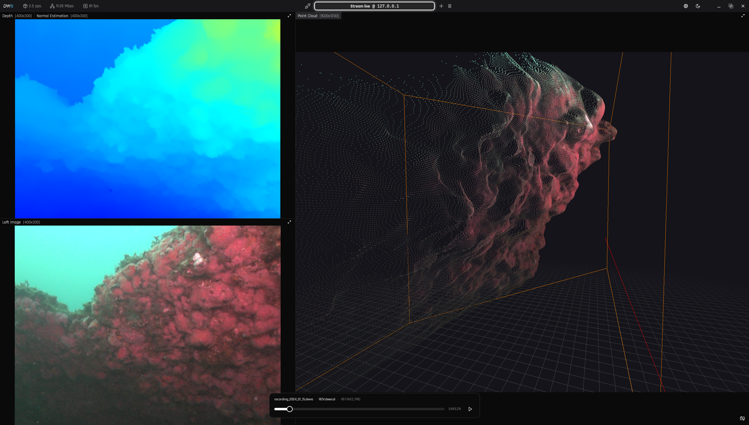
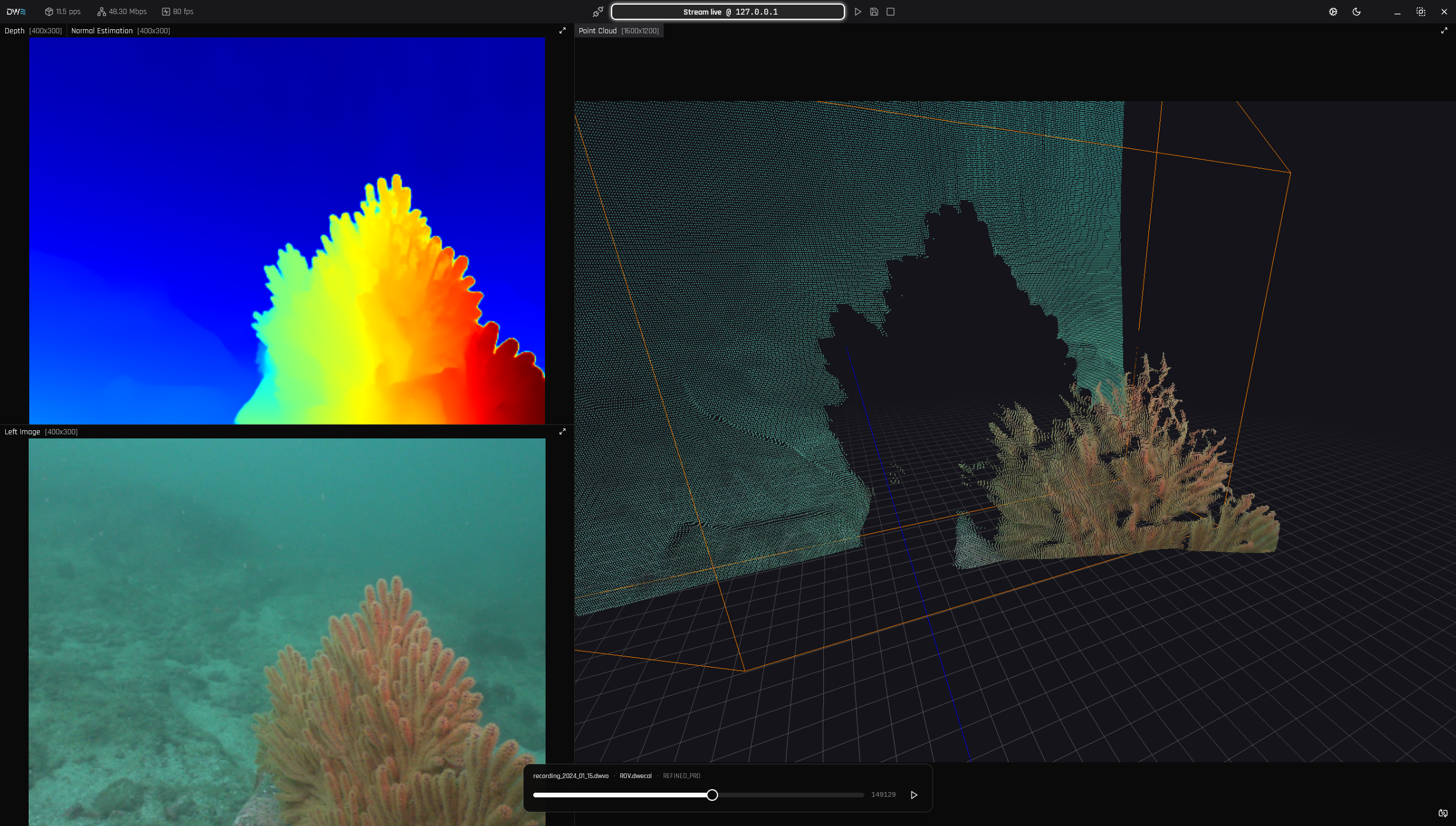
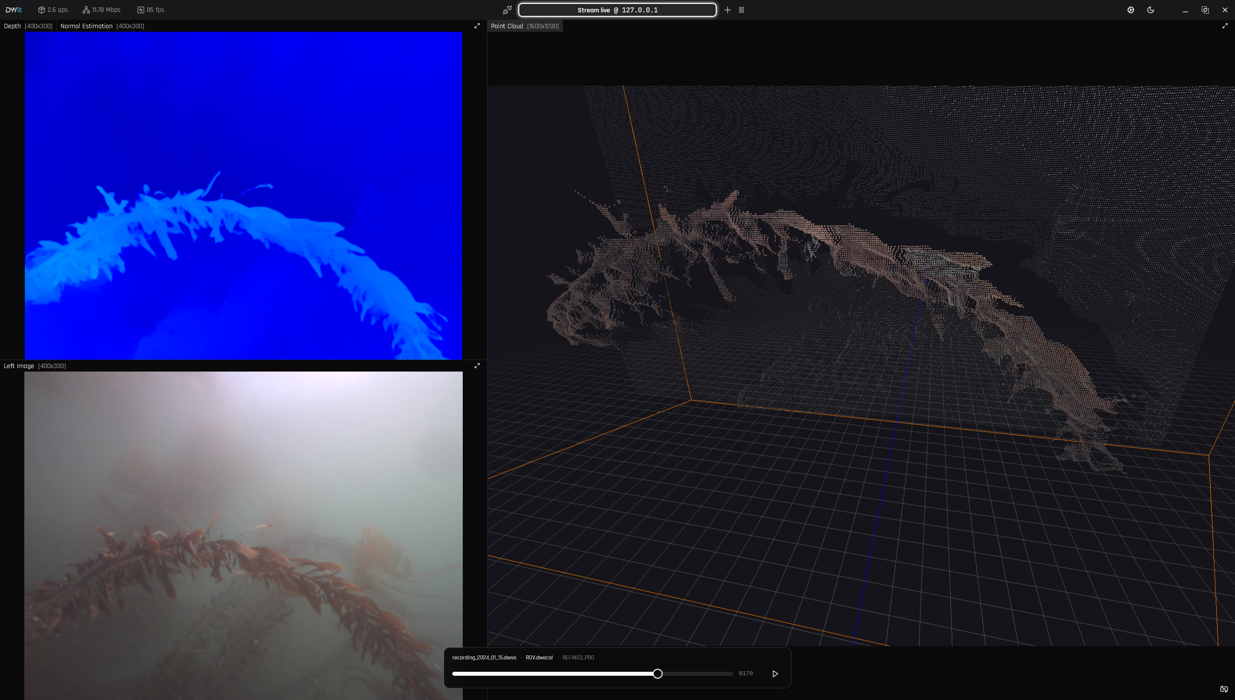
3D Point Cloud Visualization
Paired with DeepWater Desktop, give your operations a running start with 30+ FPS 3D point clouds and depth mapping* , seamlessly integrated into DWE OS, ROS, or custom pipelines. Accelerate offshore inspections, enhance environmental monitoring, and enable faster threat response times with true real-time intelligent vision.
* Tested with Nvidia Jetson Orin NX on our Refined Fast Model

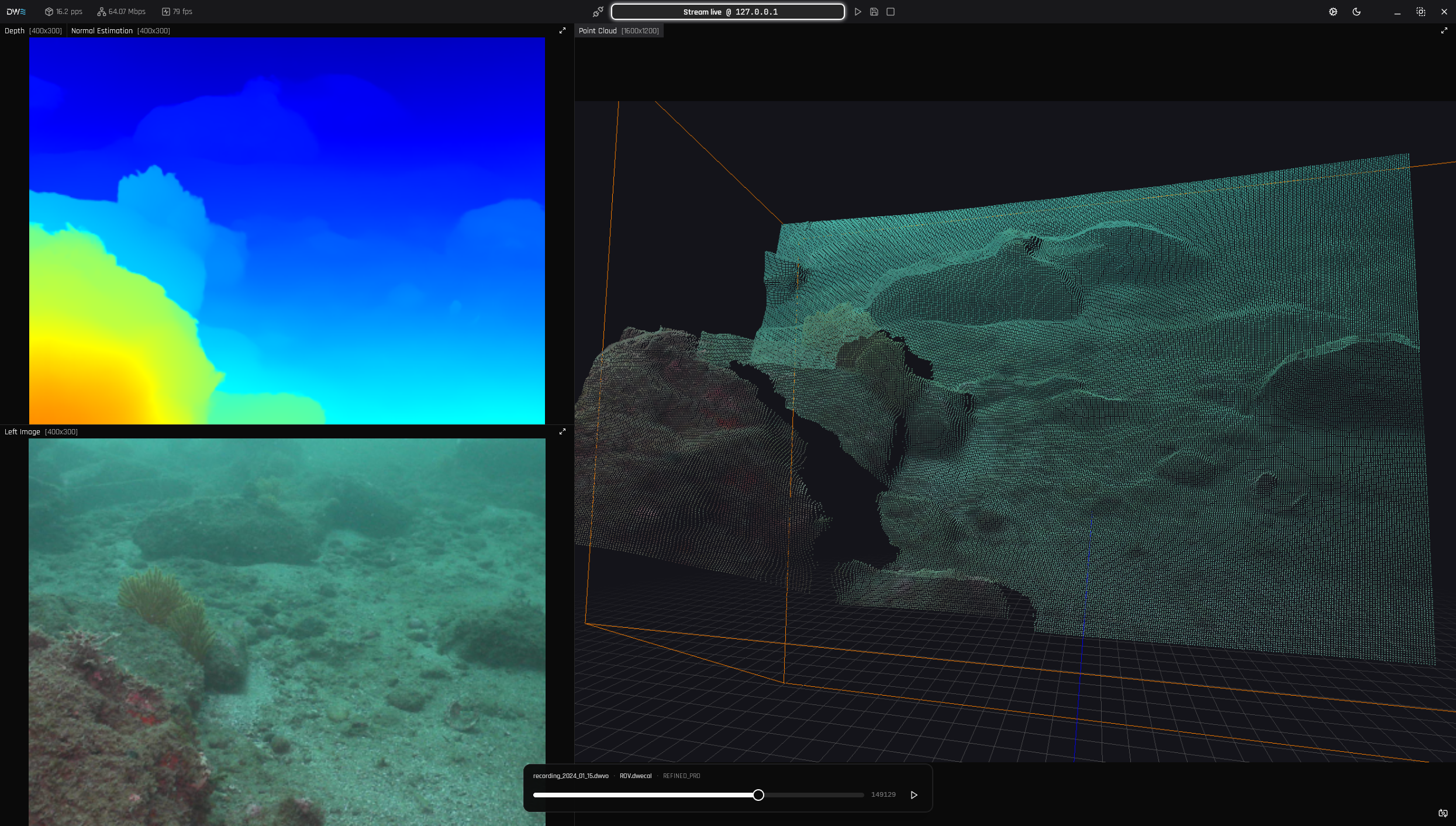
Real-Time DWE SLAM
Generate Visual SLAM (VSLAM) maps within the DeepWater Desktop while simultaneously recording frames locally on the SVC Pro. This ensures full map coverage for highly detailed 3D post-reconstruction, while providing quick, actionable measurements and insights in real time.
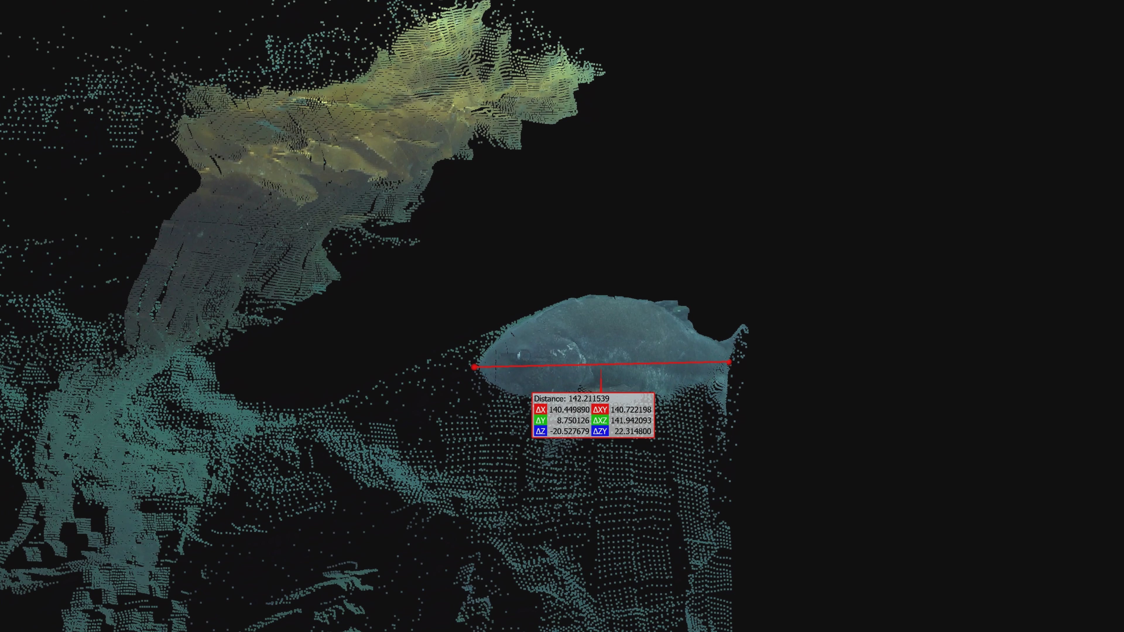
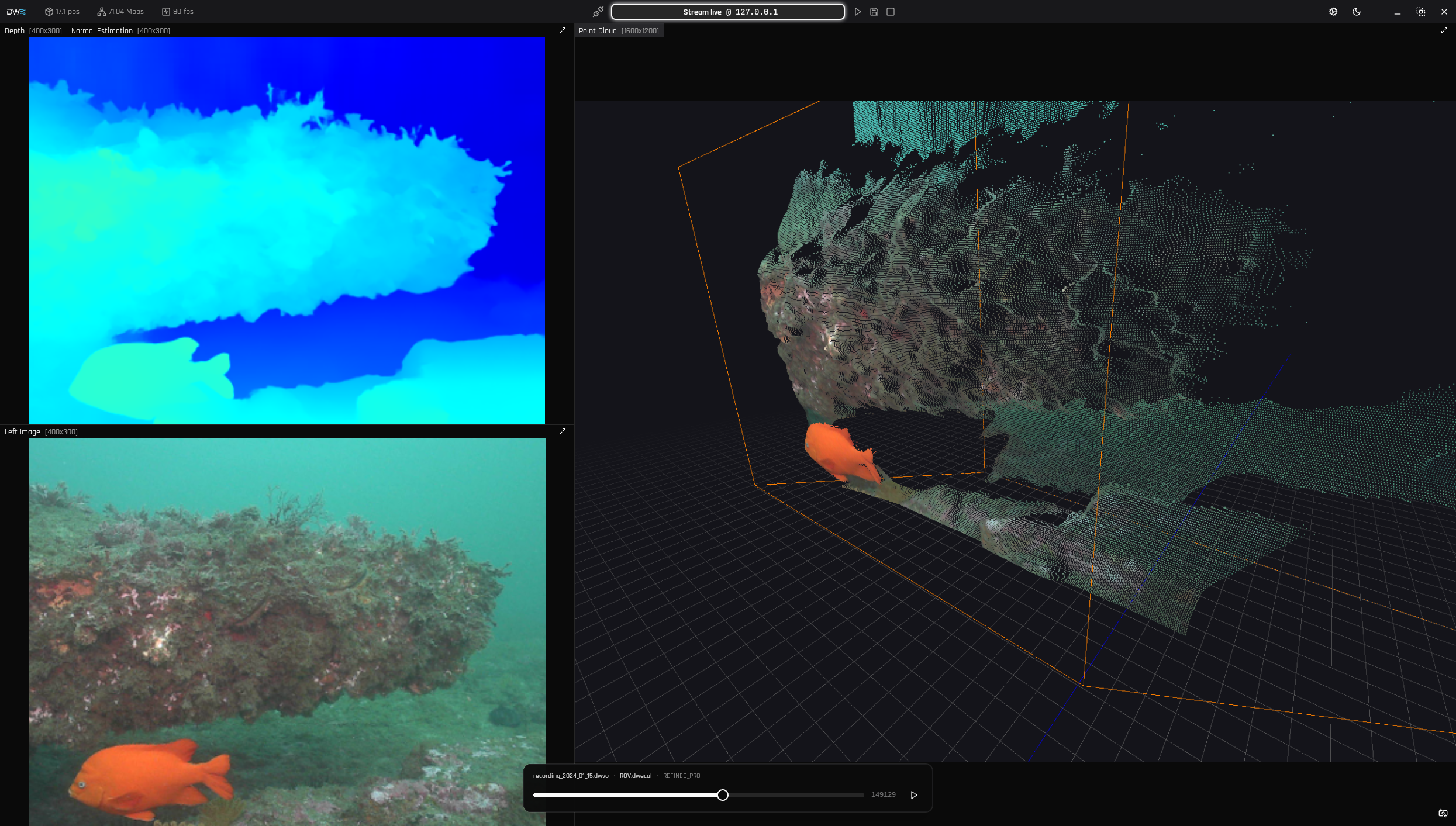
Measure any Object in Real Time
Capture real-time measurements of any object, whether it's moving fast or standing still. Unlike other systems that require slow, full 3D reconstruction and mapping, our advanced 3D point cloud system instantly analyzes spatial data to give you the power to capture dimensions and perform complex analysis with unmatched speed and efficiency. As long as key points are visible, our system delivers precision as accurate as using a physical ruler to measure an object.
Discover the Software Powering the explore3D
Maximize your underwater surveying capabilities. Our dedicated desktop software ingests explore3D imagery and depth data to render live point clouds and VSLAM maps, giving you total control from data acquisition to final analysis.

High-Detailed 3D Reconstruction
Generate immersive, high-fidelity spatial representations of complex environments with our advanced depth mapping and point cloud visualization. By capturing intricate details and transforming raw spatial data into highly detailed 3D reconstructions, the system provides a complete and accurate visual understanding of your surroundings, allowing you to easily navigate and analyze intricate underwater topographies.
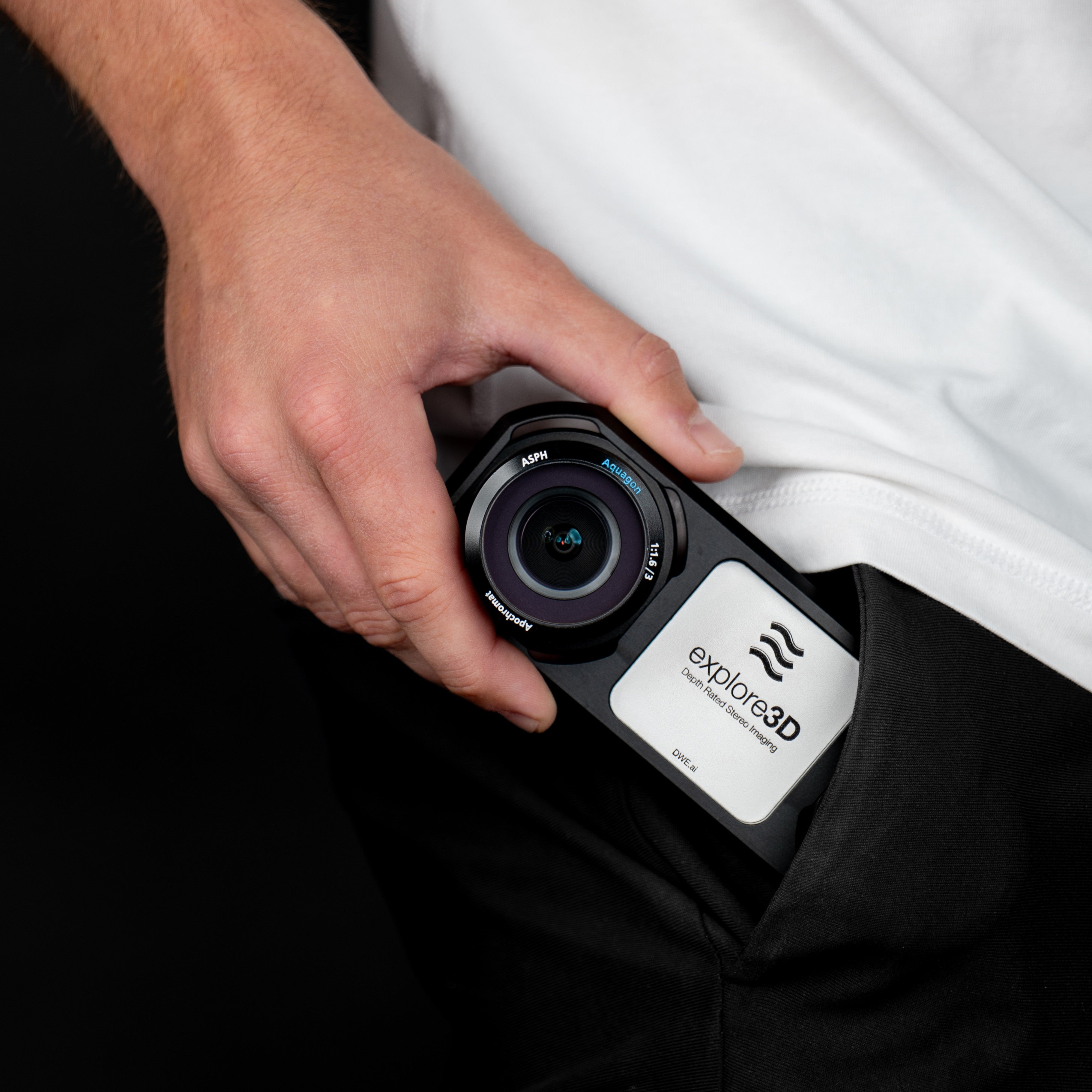
Unmatched Performance in a Compact Form
Leveraging our millisecond-accurate synchronized, global shutter cameras operating at 60 FPS and our Aquagon® optics, we guarantee that our stereo camera delivers superior performance and output quality compared to our competitors, at a fractional cost and size.