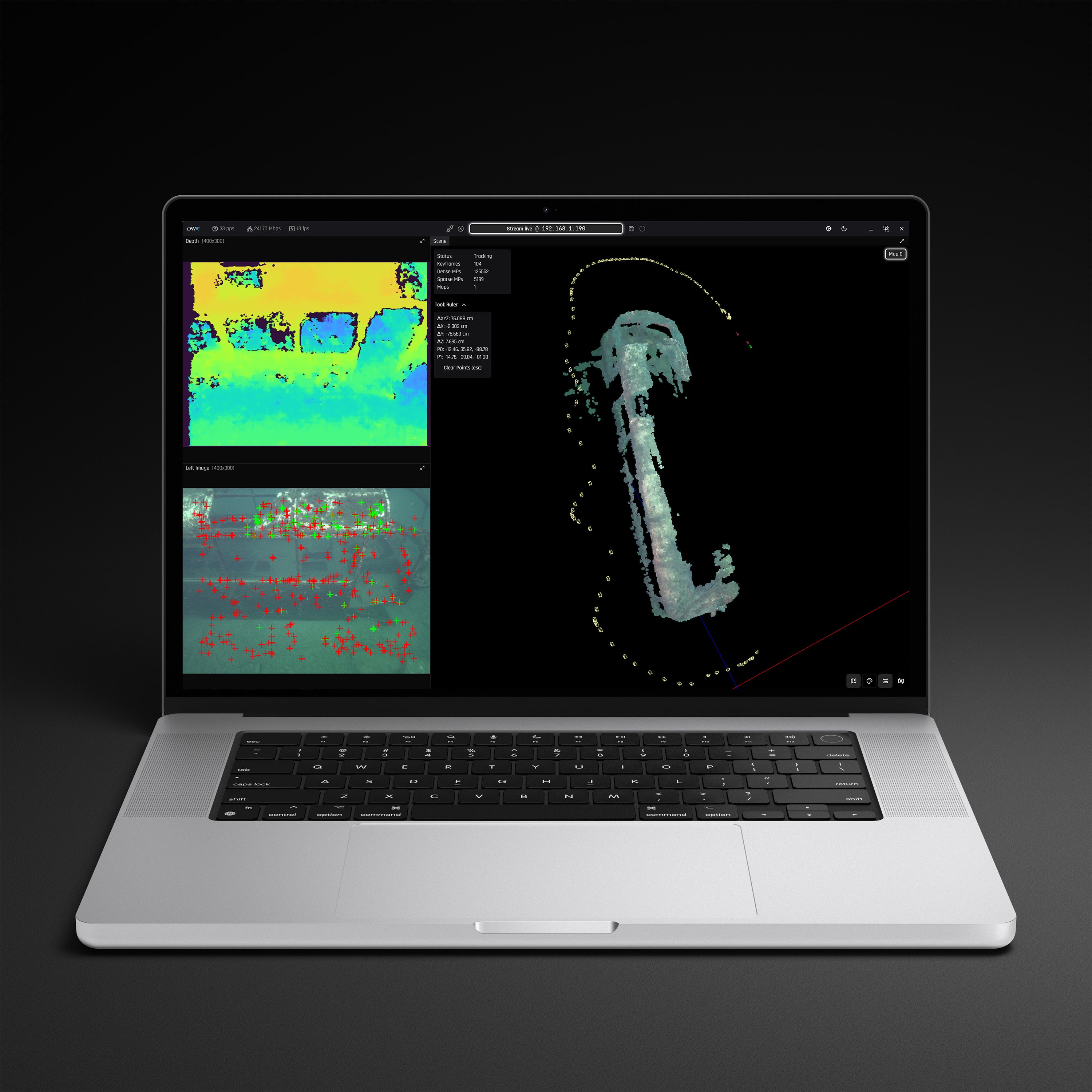
From Raw Camera Feeds to Actionable 3D Intelligence.
DeepWater Desktop delivers instant visualization and true-scale physical metrics directly to the operator interface.
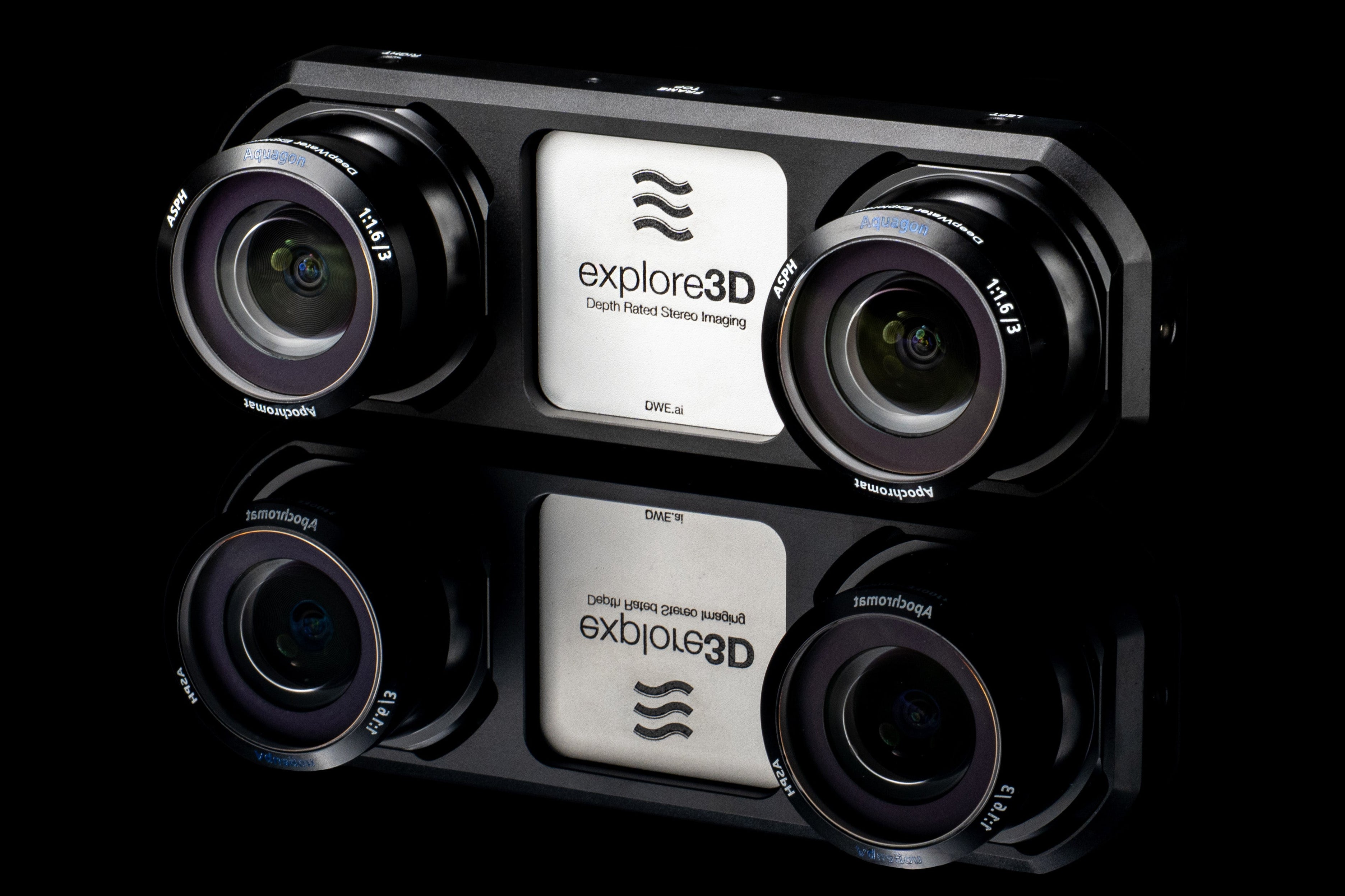
Natively integrated with the explore3D stereo camera and SVC Pro for edge compute, the platform unifies subsea data acquisition and geospatial analysis into a single, high-efficiency workflow for underwater inspections, surveys, and autonomous navigation.
Complete Visual Intelligence

Real-Time 3D Perception
30+ FPS point clouds and depth maps, optimized by our distortion-eliminating Aquagon® lens, delivers accurate, true-scale spatial intelligence. Instantly visualize complex environments in 3D with real-time depth perception during subsea inspection and autonomous navigation.

Mapping & Localization
Generate live maps and track vehicle trajectory with our robust VSLAM algorithms, ensuring complete area coverage during surveys and allowing for pinpoint navigation in GPS-denied environments.

Precise Live Measurements
Pause the live point cloud feed at any time to instantly take measurements in the field while your vehicle remains fully deployed.
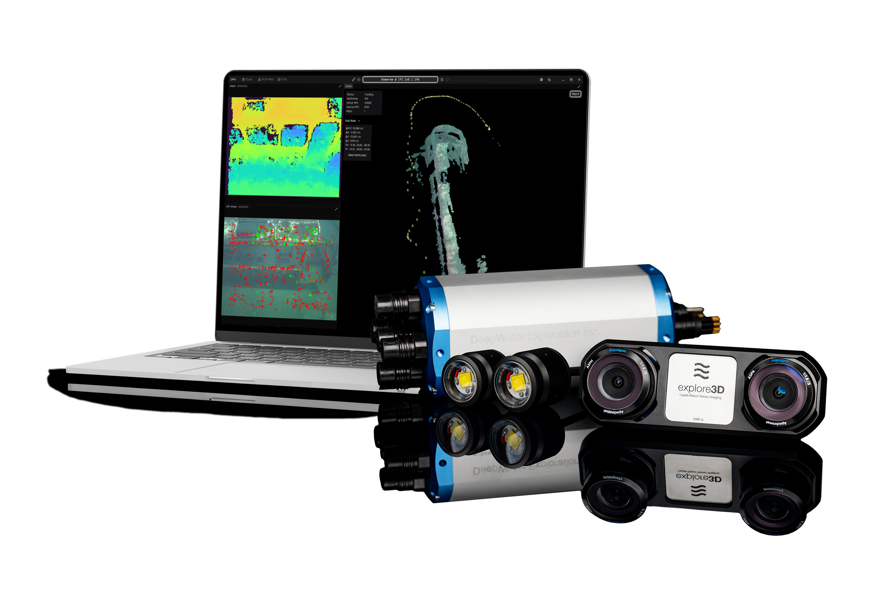
Buy Once. Deploy Forever.
No subscriptions, seat-licenses, or recurring fees.
DeepWater Desktop comes preinstalled with the explore3D Stereo Vision Kit and runs entirely locally, providing a 100% offline, mission-ready vision solution with a transparent TCO.
If you have any questions, you are always welcome to contact us. We'll get back to you as soon as possible, within 24 hours on weekdays.
-
Shipping Information
Use this text to answer questions in as much detail as possible for your customers.
-
Customer Support
Use this text to answer questions in as much detail as possible for your customers.
-
FAQ’s
Use this text to answer questions in as much detail as possible for your customers.
-
Contact Us
Use this text to answer questions in as much detail as possible for your customers.
The Full Vision Stack

SVC Pro (NVIDIA Jetson Orin NX 16GB)